Several members asked me in the recent past on which GPS model to buy and where to get proper topographic maps for India. A GPS and a good topomap is essential when exploring new locations.
A GPS unit does not require a subscription (to receive your position from the satellites). Once you buy the unit it can be used free of cost, in any part of the world. The main problem is the availability of usable maps for India. Most units either come with a base worldmap which is pretty much useless for hiking. Good topographic maps are available but mostly for US and Europe only. For India no ready-to-use maps are available for GPS units rendering your GPS typically useless for navigation.
Below is a quick summary on the available options, where to buy and where to download good topo maps for India.

Low end


For those looking at the most economical option, you can get a low end Garmin eTrex GPS unit starting from 120 USD onward (less then 6K INR) or even less for a second hand unit from eBay. Best is to ask a friend who is travelling back from the US to order it locally (e.g. from amazon) and bring it over as the same units in India are much more expensive (e.g. Electronic Labs, T Nagar). We have been using eTrex units for navigation in the earlier days in CTC. It's a field proven unit which is very compact, sturdy for the outdoors and works on 2AA batteries.
So where to get maps? In 2000 as part of the SRTM mission, NASA generated a digital elevation model for most of the world with a resolution of 3 seconds or 90 meters (1 second for the US). http://en.wikipedia.org/
This topographic data can be freely downloaded at (HGT vector format) - http://dds.cr.usgs.gov/srtm/

One can use the GroundTruth program to download and extract contours from the SRTM data - http://wiki.openstreetmap.
1. Go to http://www.openstreetmap.
2. Run groundtruth contours -bu="http://www.openstreetmap.
2. Run groundtruth makemap -ibf=output.ibf
3. Run groundtruth ibf2osm
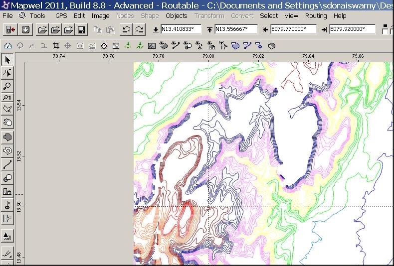
This will generate ".osm" files which contain contour lines for the indicate area and which can then be viewed in most mapping programs. You can then use your mapping tool (e.g. Mapwel) to load the contours into your GPS unit. Note that these are vector data which can be zoomed in/out rather then just raster/bitmap files. Below a photo of an eTrex unit bought for 100USD on eBay by one of our members loaded with contours from SRTM for last weekend Palani PX/4 trek -

High end
For those who can spend a little more, you can go for the Garmin GPSMap62 unit which comes around 300USD (around 15K INR). Many of our members have this unit which comes with more memory and CPU power to handle maps in the open KMZ format. Google terrain maps and any geo-referenced soft copy map (or scanned in paper map) can be easily downloaded into these units. CTC has been using this model for the past 2 years. At least 5 members bought this model last month. The unit comes with a bigger antenna which has better reception in narrow valleys and below dense forest cover.
In this higher end unit you can download Google topo maps. Go to maps.google.com, switch to "Terrain" view and zoom into your location of choice.
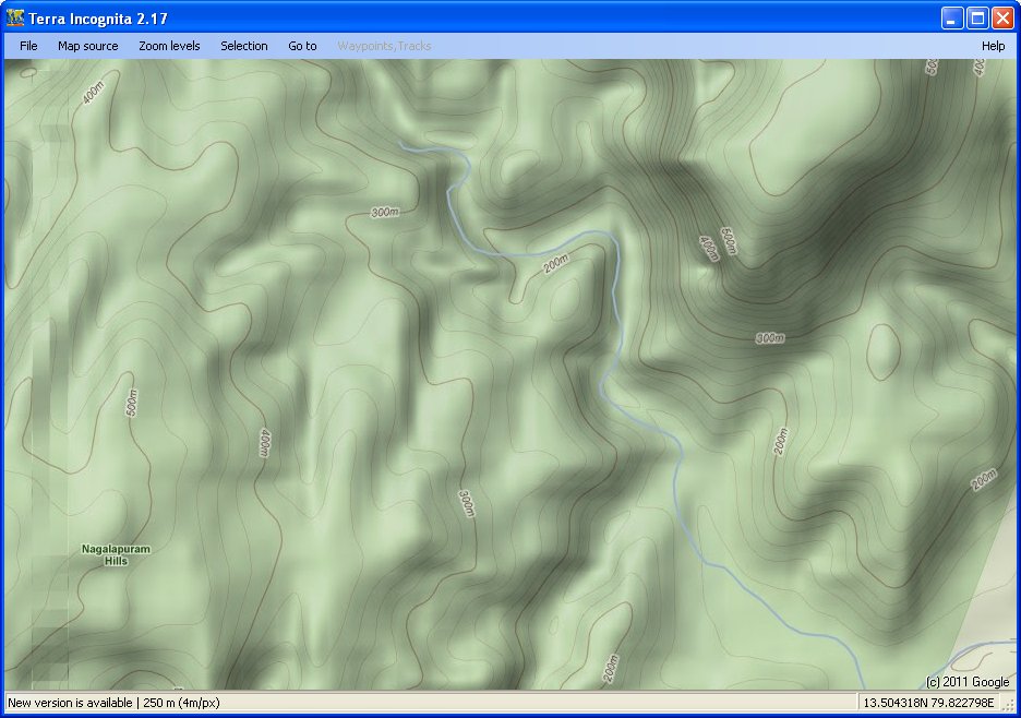
At the highest three zoom levels you will see contour lines appearing. You can download these (and other) maps using the Terra Incognita tool -

Simply download the tool, choose Map Source, Google Terrain, zoom into to your location of choice
Choose Selection, Rectangle Section, indicate the bounding box
Now zoom in to the highest level (250m) and File - Save Map - OpenGIS KMZ map.
This generates a KMZ file (basically a compressed ZIP file containing map tiles in JPG format, each with latitude/longitude) which can be copied onto your GPSMap62 unit (GPX\CustomMaps directory). Note that these are raster/bitmap files which you can zoom in/out within a limited zoom range.
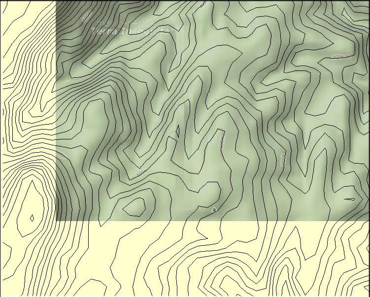
When overlaying the SRTM data and Google terrain maps (see below) one can clearly see that both are nearly identical. Google most probably used the same SRTM data, made the contours a little more curved/rounded, added shading and filled in some missing gaps. After trying out a low endTrex loaded with SRTM contours this weekend in Palani I find this combination to be equally good for navigation as our usual GPSMap62/Google Maps combo.

Those interested to know more about topo maps, GPS and navigation can read more on our web site - http://www.chennaitrekkers.

2 comments:
Much of Google map content, roads, trails, rivers (not contour lines) are editable by anyone who cares to at Google Map Maker: http://www.google.com/mapmaker. Some of you trekkers might consider editing content to improve Google Maps.
Nice one....I realized the importance of carrying GPS devices while going on a trek last year when our group got lost in the jungles and had a hard time coming out. I have now bought Garmin eTREX Vista GPS device from this website http://www.playgroundonline.com/Outdoor+and+Adventure-Outdoor+accessories-GPS+Devices and will keep with me next time I go on trek.
Post a Comment